Aztec Butte Trail
Canyonlands National Park
Distance: 1.6 miles (2.6 km)
Cumulative Elevation Gain/Loss: 283 feet (86 m)
Date Visited: Thursday, March 29, 2018
Aztec Butte Trail Map (KTNP)
A butte is a striking rock formation, defined as an isolated steep hill with often vertical sides and a flat top. It was time for us to hike to one in Canyonlands National Park. Aztec Butte is a 1.6-mile out and back that leads to the top of a butte, with a side trail to see some Puebloan ruins. We were particularly looking forward to the archeological features of the area. The drive to the Aztec Butte trailhead was only about a mile from Mesa Arch Trail, which we had just hiked.
The parking lot was fairly empty, especially compared to Mesa Arch, so we anticipated more solitude. The trail is rocky at the start, before giving way to a sandy path. After a short 0.3 miles, we reached the first intersection. Taking a right would lead us directly to Aztec Butte, but we turned left toward the Puebloan granary ruins on a separate, smaller butte. The trail took us up some slickrock, and gave us a view into Taylor Canyon in the distance. Rock cairns guided us to the granaries, which are sheltered by a rock ledge.


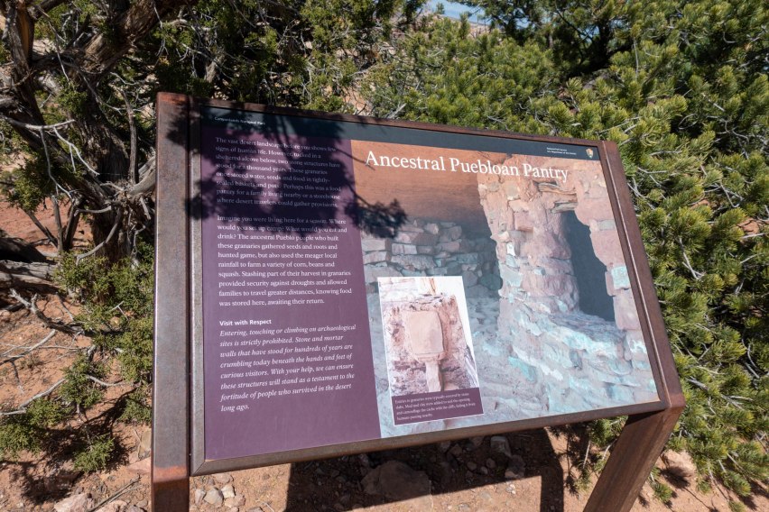
Alongside the ruins are some informative park signs. We learned that Ancestral Puebloans stored pots and baskets containing food, water, and seeds to be protected in the granary. We explored and took some photos. Built between 1200 and 1300 AD, the two granaries we saw seem to be well preserved. On a side note, please remember not to touch or enter them.
After checking out the granaries, we retraced our steps and continued on the main trail. At the base of Aztec Butte, we were greeted by a steep 200 foot ascent. The sandstone is beautiful, with striations in shades of red, white, and brown. It was totally exposed to the sun as we climbed, but it’s a short and enjoyable route with some scenic views.


A vaguely defined trail loops around the top of Aztec Butte. Along the loop are other structures. Some might be authentic, but others may have been constructed more recently – we didn’t see any signs at the top to explain the history, though. For example, a four-walled stone structure sits at the southeast corner of the butte.
There are other ruins scattered around the butte, but some are harder to find than others. We didn’t know it at the time, but there are granaries just below the west ridge of the butte. After exploring more, we headed back the way we came. We pondered why the site is called Aztec Butte, and thought it might be a misnomer, but we haven’t been able find a source explaining its name.
Both Aztec Butte and Mesa Arch are fun hikes with sweeping views, though they are very different. We preferred Aztec Butte Trail since it’s a longer hike with fewer crowds and a rich history. And as a bonus, we kept joking about how “butte-iful” the area is.


Aztec Butte Trail
Date: Thursday, March 29, 2018
Type: Out and back day hike
Total Distance: 1.6 miles (2.6 km)
Cumulative Elevation Gain/Loss: 283 feet (86 m)
Time: 1.5 hours, at a leisurely pace including photography
Trail Markings: Wayfinding Cairns
Difficulty: Easy to Moderate
Crowds: A few other groups
Water: None
Highlights: Geological Features, Views, History, Ruins
Directions to Mesa Arch Trailhead: Google Maps Directions
Notes: It can get hot, so bring plenty of water.
Trail Directions
- 0.0 mi – From the parking lot, head east on Aztec Butte Trail.
- 0.3 mi – At the intersection, turn left toward the Puebloan Granaries.
- 0.4 mi – Arrive at the granaries. Explore, then head back the way you came.
- 0.6 mi – Back at the intersection, turn left toward Aztec Butte. You’ll ascend about 190 feet to the top.
- 0.8 mi – Arrive at the top of Aztec Butte. Head either way on the vaguely defined loop trail.
- 1.0 mi – Back at the start of the loop. Go back the way you came to descend.
- 1.3 mi – At the intersection with the granaries, go straight back toward the trailhead.
- 1.6 mi – Back at the parking lot.
Places
- Aztec Butte | 38.397298, -109.874844

